
How does GPS Work?

satellite header image
Courtesy of NASA
Let’s talk about global positioning systems, or GPS. You probably use them every day, yet the magic behind knowing where you are can be downright mysterious. Here at Mercedes-Benz of Littleton, we will continue with our trend of cluing you into the coolest vehicle-related technology. We’ve explained the science behind Bluetooth, the history of road signs, and the reason some countries drive on the other side of the road. Now, let’s continue our series of blogs designed to make you the most educated car driver around.
GPS and Satellites
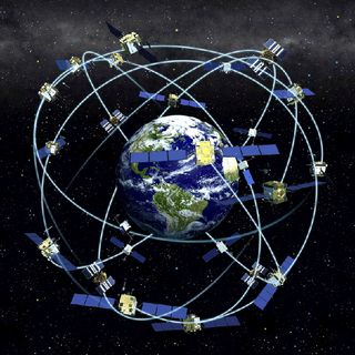
Courtesy of Space.com
Most people know that GPS has something to do with satellites. But did you know that at any time, at least four satellites are buzzing above you, essentially visible except for the clouds and sun? There are currently 27 satellites making GPS work. 24 of those are operational and 3 are backups. Each satellite weighs up to 4,000 pounds and rockets all the way around the Earth twice each day. In terms of fancy gear, the satellites are equipped with solar power and their very own atomic clock. Keep reading to find out why knowing the time is very important for knowing where you are.
GPS Basics, Explained.

Courtesy of GISGeography.com
So how does GPS work? It turns out that finding out where you are has everything to do with knowing what’s around you. The essential mechanism of GPS is, therefore, finding out the location and distance to a few satellites. A GPS system has at least two components: a receiver (the part that is in your car) and the satellite. Both parts communicate via radio waves. (Check out a recent Mercedes-Benz blogpost about Bluetooth for a refresher!). As the receiver gathers information from the satellites, it begins to draw circles in space of where it might be. Where all of the circles intersect must be the location of the server. In 2D, this mathematical process is called triangulation and requires 3 points of reference. For satellites in 3D, 4 references are needed, but more satellites help for increasing accuracy.
That all makes sense in theory, but the practicality of measuring the distance from your car to four satellites is a little trickier. It all relies on knowing precisely what time it is. The best clocks out there are atomic clocks but they are very expensive. Therefore, the satellites have atomic clocks, but the receivers have quartz clocks that can reset based on feedback from the satellites. Basically, the receiver knows that all three satellites must be telling it a distance that all lines up to the same point – the place in space where the receiver is. The receiver can figure out this point and then do the math backward to figure out what time it is on the atomic clocks aboard the satellites!
Figuring out where the satellites are is a little easier. Scientists calculate their orbital paths in bulk and equip all receivers with an almanac.
The History of GPS
Did you know that the U.S. Department of Defense first created GPS for military use? The original version was named NAVSTAR GPS, but the modern conception was first released in 1978. However, the full suite of current satellites wasn’t operational until 1993. Although GPS was originally intended for the military, the government released the technology for civilians across the globe in the 1980s. This was before the full system was even complete!
This history of open-access hasn’t been without its stains, however. In fact, the U.S. reserves the right to turn off access completely for any country at any time. Past uses of this power have prompted some nations to build their own GPS satellite systems. Current additional networks include the Russian Global Navigation Satellite System (GLONASS), and the independent systems for the European Union and India. China’s satellites are in the works and are expected to be operational by 2020. Meanwhile, Japan is augmenting the U.S. system with additional satellites designed to bring greater accuracy to Asia and Australia.
Fun Facts
- GPS doesn’t require telephone or internet signal
- Many systems use GPS for figuring out the precise time and not for finding locations!
- GPS accounts for the speed of light using General Relativity
- There is no need for a user to transmit their own data to use GPS.
- Mountains and buildings can block the signal.
Go Drive Somewhere New
Now that you know the science behind GPS, go get comfortable driving somewhere new. Take your Mercedes-Benz for a spin and come talk to us if you have any questions! If you need some ideas, check out a few of our other articles to plan the perfect excursion. And if you need more Mercedes-Benz gear or service for your vehicle, go to our website or talk to a representative! Mercedes-Benz of Littleton is always here for you, whether that means bringing you science or support!
Connect with us
